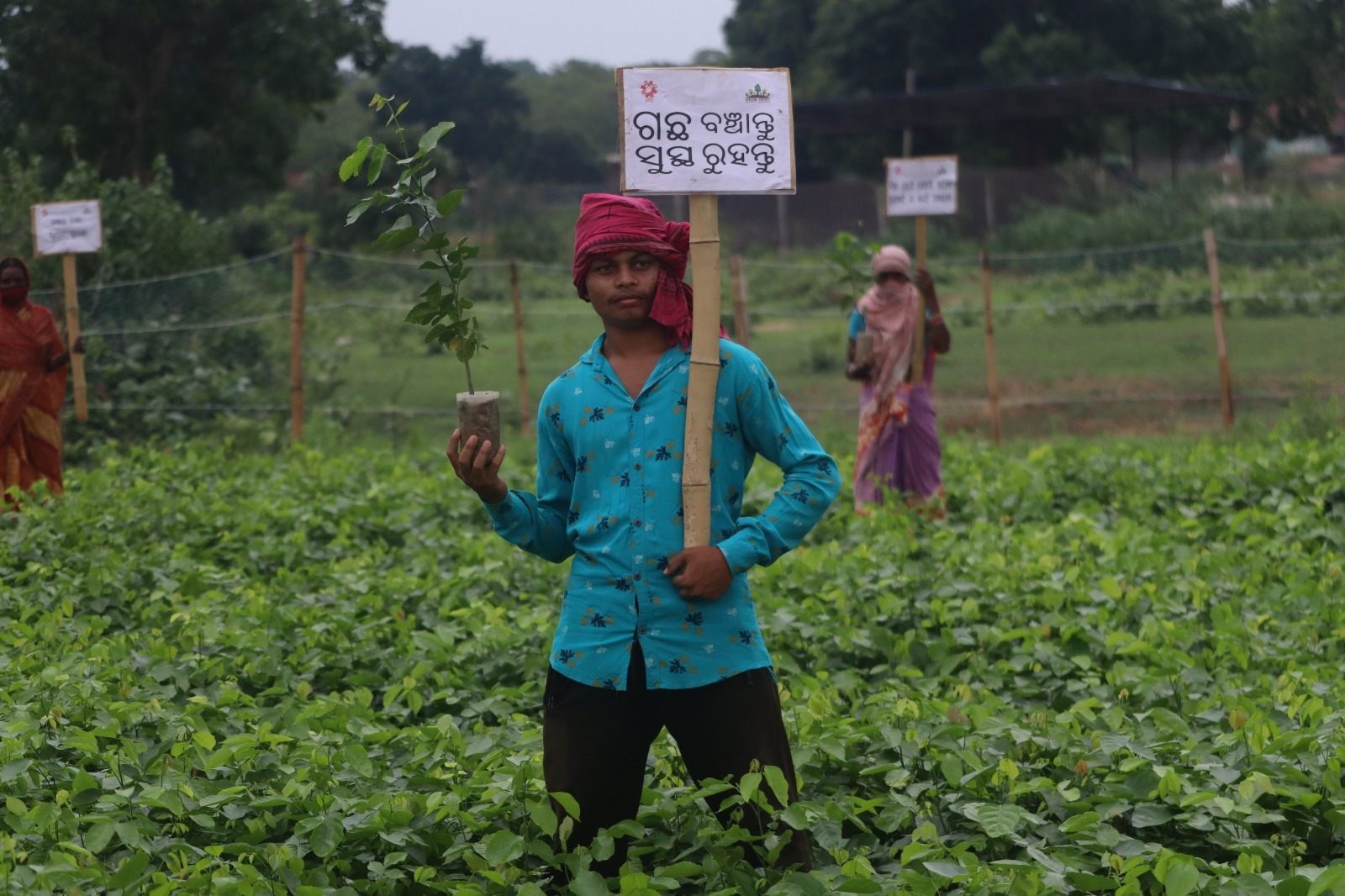
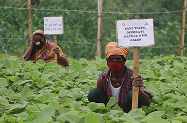
Community Plantation in Mayurbhanj district Of Odisha
This mega plantation activity covered two blocks; Bisoi and Shamakhunta in the northernmost district of Odisha, Mayurbhanj. In toto, three million saplings were planted in the regions; of different forest species, such as Amla, Neem, Sirish, Mahalimb, Teak, Acacia, Jamun etc. The seedling were raised in a nursery and then transplanted at respective community lands in 47 villages. It was project assigned to LAVS under CSR activities of a Corporate.
Details of coverage:
District
Blocks
No. of GPs
No. of villages
No. of Patches
Total Area of plantation
Total species
Total Saplings rose
Total man-days created
Mayurbhanj
02 [Bisoi & Shamakhunta]
06
27
72 [47 in Bisoi & 25 in Shamakhunta]
880.18 Ha.
13
3099460 [2012314 in Bisoi and 1087416 in Shamakhunta]
15650+
Climate proofing at Deomali and Kandamali watershed areas
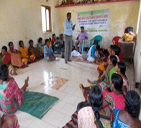
As Climate Change is universal, there are programmatic and policy implications Climate. Change imbalances the livelihoods of communities and consequently increases their vulnerability. Various coping strategies are described, to battle impacts associated with climatic variations. Climate Change is poorly understood by the participants. Men and women viewed the impact of the seasonal variations differently. Men mostly mentioned economic security while women talked about food security as its consequence. Though coping strategies are differently expressed, they implicitly boil down to economic security. The community was also not aware about sustainable strategies. The community has little scientific information about the causes of Climate Change.
They state their understanding of the causes of seasonal variations. At the same time they are not able to connect these causes to Climate Change.
Changes in the climate regime can influence natural processes of a watershed ecosystem and have long-term implications on economic and ecological processes. A general consensus is that the average global surface temperature has risen by 0.45–0.6°C (0.8–1.0°F) and the average sea level has risen approximately 15–20 cm (6–8 in.) during the last century (IPCC 2001; USEPA 2004). While the climate change can occur naturally, population growth, fossil fuel burning, and deforestationhave acceleratedthe increaseof greenhouse gasses (carbon dioxide, methane, nitrous oxide, and chlorofluorocarbons) in the atmosphere that trap heat and warm the earth system (USEPA 2004). This trend of increasing surface temperatures could impact the hydrologic cycle and various processes of a watershed system. Specific potential impacts include changes in runoff, nutrient enrichment, sediment loading, and evapotranspiration rates in a watershed system (Band et al. 1996; Chang et al. 2001; Evans et al.2003). In spite of extensive research on specific impacts of climate change, research and information on the impacts of climate change on watershed systems remain in its infancy. Evaluation of climate change on the watershed system is important to develop alternative strategies and policies to mitigate the impacts of global warming.
NABARD supported under its kFW project to implement the climate proofing program in Deomali and Kandamali watershed areas in Pottangi block of Koraput district. The paragraph below describes the geo-physical characteristics of the covered areas.
Due to its location within the physiographic region of the Eastern Ghats, the Pottangi project area is characterized by undulating terrain with slope gradients even higher than 50 percent and a range of altitudes varying between 800m to 1600m above MSL. Koraput and its adjoining districts belong to the AEZ 12 Agro-Ecological Zone.
Details of coverage:
District
Blocks
Watersheds
Total treatable area
Total Households
Total Population
Period of implementation
Koraput
Pottangi
02 [Turia and Taupadar]
Watersheds
1899.04 Ha. [Turia 1217.19 Ha. and Taupadar 681.83 Ha.]
[231 Turia and 165 Taupadar]
[1016 Turia and 726 Taupadar]
Turia [3 years:
Taupadar: [4 years: 2017:2020]
Koraput district mainly falls under 12.1 zone, but a small part at the border to Andhra Pradesh is part of AEZ 12.2 (NBSS). Soil erosion, low fertility, soil acidity and poor drainage are the major constraints occurring in this region (NBSS). The climate is warm and humid with mean maximum and minimum temperatures of 30.6 °C and 17.03 °C respectively (Koraput District). April and May are the hottest months whereas December and January are the coldest months of the year. During December and January occasionally temperature drops below 10 °C at night. The average annual rainfall of the last 22 years has been recorded as 1,540 mm with highest precipitation from June to September.